+91-9622371850 apekshaadventure@gmail.com
Best Seller
From₹150,000₹120,000
Booking Form
Enquiry Form
Full Name*
Email Address*
Travel Date*
People*
Your Enquiry*
* Creating an account means you're okay with our Terms of Service and Privacy Statement.
Please agree to all the terms and conditions before proceeding to the next step
The tour is not available yet.

Proceed Booking

Save To Wish List

Adding item to wishlist requires an account

3191

Why Book With Us?

  • No-hassle best price guarantee
  • Customer care available 24/7
  • Hand-picked Tours & Activities
  • Friendly and knowledgeable staff

Get a Question?

Do not hesitage to give us a call. We are an expert team and we are happy to talk to you.

+919622371850,+917456877193

apekshaadventure@gmail.com

Auden’S Col Trek

0
  • UttarakhandRegion
  • UttarkashiDistrict
  • 16 DaysDuration
  • Difficulty LevelDIFFICULT
  • 5490 mts.Highest Altitude
  • 75 KilometersTrekking Distance

Brief Description

Auden’s Col is the holy grail of trekking in the Western Himalayas – hailed by many as being more difficult than Kalindi Khal, which is one of the most dangerous treks in India. As a mountain pass hanging at the impressive altitude of 5,490M, this impossibly high, glaciated pass between the ginormous Gangotri and Jogin massifs is the climax of a long, treacherous journey between the pilgrimage towns of Gangotri and Kedarnath.

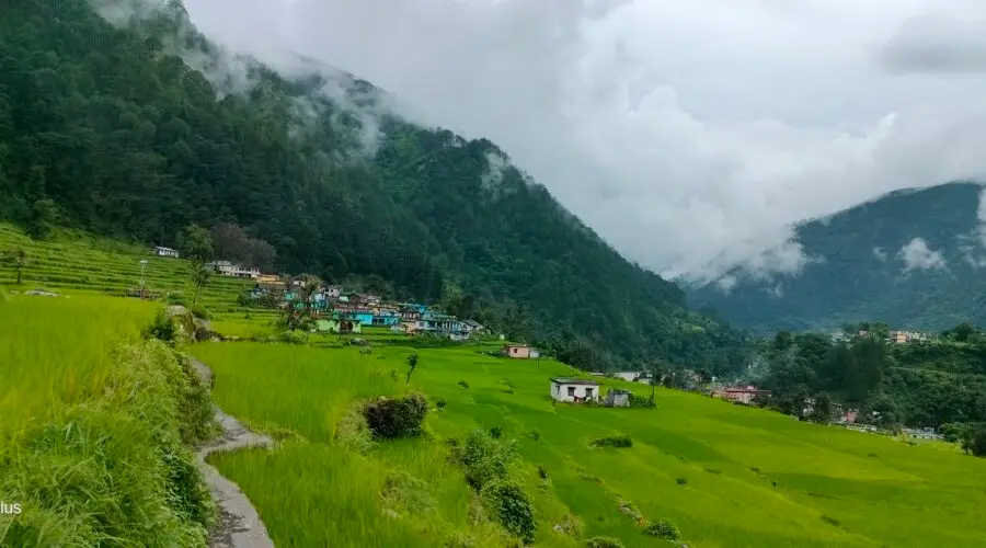
Starting from the high mountain town of Gangotri, which is possibly one of the best trailheads in the country, the trek takes you high in the Garhwal Himalayas in the massive Gangotri glacial region. The mighty Bhagirathi flows loud and proud, from its glacial source at the foot of Chaukhamba, down through vast meadows and dense deodar forests. Auden’s Col is by no means a monotonous landscape. You climb through dense birch and oak forests on the first day, onto vast, unending meadows with panoramic views of the Gangotri and Jogin peaks. You leave the meadows for harsh, alpine terrain – over moraine fields with hidden lakes, onto steep snow slopes for the final pass climb. Once you climb the pass, you walk through one of the most heavily glaciated regions in India – the crevassed Khatling glacier. Then back onto moraine and through dense forests once again before visiting the holy Vasuki Tal lake and the snow-covered Mayali Pass.

The first crossing of Auden’s Col, through this beautiful trail which links the Khatling and Rudra valleys was made by J.B. Auden, a British surveyor, in the year 1939 with the next recorded passing of the col, a long 44 years after. With everything that’s challenging and awesome about Auden’s Col – the glaciated approach, the lush and beautiful lower valleys, the unending moraine, and the magnificent views, the pass remains one of the least explored in the country even today.

On the one hand, the trek is an easy pick for its scanty crowds and a perfect assortment of beautiful landscapes along with unmatched views of revered peaks in the range. But on the other hand, it is feared to be a hostile trail where the dangers encountered outweigh the scenic beauty of the terrain. For the distance covered and altitude gained each day, there are no ‘easy’ days here. The trek requires immense patience, and doesn’t forgive those who don’t acclimatize well.

That being said, this trek brimming with raw beauty and laborious challenges, is perfect for seasoned trekkers looking to step up their trekking game in the Himalayas.

Stay on this page for more details about Auden’s Col Trek.

Itinerary

Day 1Make your way to Gangotri (3,415M)

The trek begins from Gangotri which is a mountain city on the banks of River Bhagirathi and is known to be the origin of the holy River Ganga. Located in the Greater Himalayan Range, legend says that this is where Goddess Ganga descended when Lord Shiva released the river from the locks of his hair. This holy city which lies at an altitude of 3,415M is a 245 km drive away from Dehradun – the closest city with an airport.

If you have signed up with Bikat for a drive from Dehradun to Gangotri, the day starts early. Everyone assembles at the meeting point by 7 in the morning so we can start our long drive up to Gangotri, a holy mountain city in the Uttarkashi district of Uttarakhand. Although there’s nothing more on the agenda for today other than the 8-9 hour drive, it is better to leave as early as possible for two reasons:

One, so we can reach as early as possible and give our bodies enough rest for what’s coming the next day. And, two, roads on the mountains are unpredictable and it is always better to account for delays when we start. It is also better to reach before it gets dark.

Day 2Rest and acclimatization at Gangotri (3,415M)

Day two is reserved for rest and for acclimatization to the altitude. This is important to allow your body to adapt to its new environment and reduce chances of adverse health conditions. You can go around and explore the market, delve into the colors and culture of this high-mountain town and visit some places nearby. A little movement around the city would be good for acclimatization. Also, use this time to go through your checklist and do some last-minute shopping for what you might be missing for the trek.

While the body acclimatizes, we take this time to get together with the group for a debriefing session where we get to know each other better and delve into the happenings of the next few days – schedule, what to expect, basic do’s and don’ts in the mountains, how to maintain the sanctity of the environment and other such matters of importance.

We also go for a short acclimatization walk in the evening to adapt to this new environment better.

Day 3Gangotri (3,415M) to Nala Camp (3,760M)

Our first day of trekking in this treacherous terrain involves an altitude climb of close to 350M. The trail for most parts runs through dense forests that occasionally open up to miniature grasslands with unclouded views of limpid skies above.

We head southwest from Gangotri, walking down the main valley for around 2 km and then turn east into the Rudugaira valley. The trail from here gradually climbs up through thick oak and birch forests. On crossing the nala, the tree line begins to thin out giving way to wider expanses of landscape in the form of meadows and grazing grounds. Our approach to the campsite for the day offers magnificent views of Gangotri III and Jogin II which looks like a sharks fin when viewed from a certain angle.

On reaching the campsite, we rest our weary selves for a bit, get some fuel in the form of hot food and head out for an acclimatization walk early evening.

Day 4Nala Camp (3,760M) to Rudugaira Camp (4,350M) Distance: 4 km

On the agenda today is a 600M altitude gain across a short distance of 4 kms. Needless to say, the ascent up to Rudugaira Base camp will be steep and grueling. Going further ahead from the Nala Camp, the trail climbs to the upper grazing grounds which, if you are lucky, will offer up countless herds of Bharal (Himalayan Mountain Goats) sprinting around these high mountain lands. After crossing a few streams, we begin our climb up a steep spur which will take us straight to Rudugaira Base Camp.

We pitch our tents in this beautiful campsite covered in snow and surrounded by famous peaks such as Gangotri I, II, III and Jogin III.

Day 5Rest and Acclimatization at Rudugaira Base Camp (4,350M)

Today is reserved for acclimatization to the altitude since we gained quite a bit of height in the last two days and have also entered a much different terrain. After a late breakfast we go for an acclimatization walk. On climbing just a few hundred meters from the campsite, we get our first view of Auden’s Col which is inspiring to say the least. We end the day early so as to get optimum rest.

Day 6Rudugaira Base Camp (4,350M) to Auden's Col Base Camp (4,720M) via Gangotri Base Camp (4,500M) Distance: 8 km

Today we start early and continue on towards Gangotri base camp which is approximately 4 kms from our campsite. A short while into our trek, we get our first glimpse of Auden’s Col. The view is absolutely spectacular. Covered in white, the col appears benign as it straddles a precarious ridge from the mighty Jogin I on the east and an equally formidable ridge running from the Gangotri III peak on the North West.

Gangotri base camp to Auden’s Col base camp is a relatively short walk of 4 km, but quite difficult due to the altitude, terrain, and snow – we have now left the slopes of the valley behind and have entered the world of moraines. After a few hours of trudging through moraine-covered snow, we reach the wild and desolate Auden’s Col base camp. On our way today, we will pass a high-altitude lake by the name of Sukha Tal which is a beautiful azure lake hidden in a moraine bowl.

Day 7Auden's Col Base Camp (4,720M) to Khatling Glacier Camp (5,000M) via Auden's Col (5,490M) Distance: 5 km

Today is THE day. We will be crossing the formidable yet spectacular Auden’s Col which lies at the confluence of four huge massifs: Jogin I and Gangotri III flanking us on either side with the Jogin glacier behind us and Khatling lying in front of us. Expect this to be a tiring day.

We continue on the moraine-ridden terrain until we reach the glacier. After a short while on the glacier, we hit a patch of ascent with a gradient between 30-50 degrees which will need to be navigated with caution. We rope up for this steep patch, which spans close to 1.5 kms, for utmost safety. The climb up to the col should take close to 3 hours. However, the climb up is not the main challenge for today.

The descent from the col is tricky and requires navigating a steep and narrow gully inclined at an angle of 70-75 degrees. Once this gully is crossed, however, the glacier flattens out – the broadened valley giving way to views of massive icefalls, glaciers and formidable peaks in the region. A short walk down the glacier brings us to our camp for the night.

Day 8Khatling Glacier Camp (5,000M) to Zero Point (3,870M) Distance: 10 km

We have successfully crossed the pass and are now on the other side, but the challenge has only just begun. Today is going to be one of the longest days of the expedition and also the most demanding. We will be crossing the forbidding Khatling glacier today, which is almost 10 kms long and extremely challenging to navigate. As one of the most heavily glaciated regions in India, the Khatling glacier is a moraine-rich land full of hidden, open and deep crevasses for all the 10 kms. This unmarked route over loose gravel and scree with sections of steep ascents and descents demands extreme caution with each step forward. Towards the end, we are reunited with a marked trail which leads us to our campsite for the day by the snout of the Khatling glacier.

Day 9Rest Day at Zero Point (3,870M)

Since the last couple of days have been extremely taxing, we rest at Zero Point today.

Day 10Zero Point (3,870M) to Chowki (3,580M) Distance: 7 km

Today we will be leaving the land of snow and making own way to the warmer reaches of the valley. After 3 kms of continuing our walk along the river, we reach the meadows. Chowki, our grassy campsite after spending days in rocks and snow, is a 4 km walk from here.

Day 11Chowki (3,580M) to Masar Tal (4,135M) Distance: 8 km

We will be making our way to one of the most isolated lakes in the Garhwal region, Masar Tal, today. Stationed at an altitude of 4,135M, this pristine, high-altitude lake rests to the east of the snowy Khatling glacier. The route starts off as a steep ascent with a view of Thalay Sagar- a gorgeous peak of 6,904M that lie 10 kms southwest of the holy site of Gaumukh. After the initial ascent, we cross a ridge over the valley which takes us straight to Masar Tal. We camp by this scenic lake.

Day 12Masar Tal (4,135M) to Vasuki Tal (4,135M) via Mayali Pass (5,000M) Distance: 12 km

Onwards to another glacial lake today, Vasuki Tal is at an altitude of 4,135M. Today’s trail begins with a steep ascent over boulders on a ridge to Masar Top. The path, then, descends slightly before climbing up the glacier to reach the top of Mayali Pass – another hidden gem of Uttarakhand. The descent from here is as precarious as the one we left behind when we climbed down from Khatling glacier. This section will require the use of fixed ropes on which we will rappel down. We continue our descent down all the way to Vasuki Tal which is our campsite for the day.

Day 13Vasuki Tal (4,135M) to Kedarnath (3,590M) Distance: 7 km

We will finally be making our way to Kedarnath today – which happens to be one of the holiest shrines to Shiva. As one of the twelve Jyotirlings, Kedarnath sees a lot of pilgrims in the months when the area is not buried under snow. Kedarnath is a 7 km trek from Vasuki Tal which takes about 3-4 hours to cover. We visit the temple in the evening and spend our night in a warm bed in a hotel, after days on cold, uneven surfaces.

Day 14Kedarnath (3,590M) to Gaurikund (1,985M) Distance: 14 km

We trek down this easy, well-marked trail of 14 kms which takes us directly to Gaurikund. We will be spending our night in a guesthouse/hotel.

Day 15Gaurikund (1,985M) to Dehradun (430M) Distance: 252 km Drive

The drive back down to Dehradun is alongside the fierce Ganga River. It should take close to 9 hours to reach. Expect to get to Dehradun by late evening.

Day 16Reserve Day

In case of bad weather or other difficulties which might set us off schedule during the course of the entire expedition, Day 16 is set as a reserve day. This will only get used if unexpected and unforeseeable conditions present themselves at the last minute preventing us from reaching our destination as planned. In case this day is used, there is an extra charge of INR 4500 per person. The same will be collected by the trek leader at the end of trek.

Photos
Map
FAQ

Whats Included

Meals During the Expedition (Starting lunch on Day 2 till Dinner on Day 13)

Hotel Stay in Gangotri, Kedarnath & Gauri Kund on twin/triple sharing basis

Services of a English Speaking Trek Leader certified in AMC (Advance Mountaineering), special rescue course from NIM,
Emergency wilderness Responder course

Forest fee, permits & Camping Charges (Upto the amount specified for Indian Nationals)

4 season camping tent , Thermal rated sleeping bags & mattress

Micro spikes, Ice Axe, Gaiters, Carabiners, Harness, and Helmet, as required
UIAA Safety Equipment like Static Rescue Rope, Harnesses, Carabiners & pulleys with the Leader

First Aid Certified Local Trek guide with extensive trek experience of the route, Cook, Helper

Services of Porters for carrying common camping equipment like tents (twin sharing basis), sleeping bags & Services of kitchen stuff
Exhaustive first aid kit with a portable oxygen cylinder of 300 ltrs capacity

Whats Not Included?

Forest Charges for carrying still/video cameras etc.

Meals during hotel stay & any kind of road journey

Personal expenses like tips, telephone calls, laundry, etc
Travel Insurance, if any

Anything which is not mentioned in Inclusions list

5 travellers are considering this tour right now!
whatsapp chat